
Are UU visualisations honest?
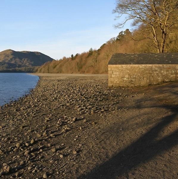
As part of their planning submission United Utilities have produced a series of ‘visualisations’ of the shoreline after 15 years. Our previous article showed how we believe Crummock will look, and now we take an iconic Crummock landmark - the boat house - to check the accuracy of their pictures. Are they telling the truth?
Both pictures show the waterline after it has dropped by 1.35m. Our research shows the new waterline 8 metres from the boathouse.
The UU visualisation appears to be a misrepresentation of the future shoreline. We have asked them for comment.


How we did it
We sent our brave researcher into the icy winter water to measure the level when the water is 1.37m deep. Brrrr! One of our young and clever helpers projected the new shoreline using CGI.
This picture was taken in April 2025.
Want to see the full UU document? Click here